
The Great Artesian Basin is the largest and deepest artesian basin in the world. It stretches over 1,700,000 square kilometres. The basin provides the only source of fresh water through much of inland Australia.
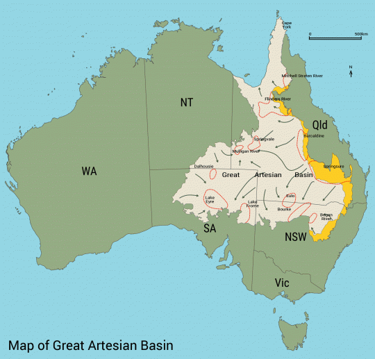
The Basin underlies 22% of Australia including most of Queensland, south east of the Northern Territory, north eastern South Australia and northern New South Wales. The basin is 3,000 metres deep in places and is estimated to contain 64,900 cubic kilometres of groundwater, enough to fill Sydney Harbour 130,000 times. The basin supports tens of thousands of people every day and, apart from rainwater tanks, is the only water source for more than 20 per cent of inland Australia.
The water of the Great Artesian Basin is held in a sandstone layer laid down by continental erosion of higher ground during the Triassic, Jurassic, and early Cretaceous periods. During a time when much of what is now inland Australia was below sea level, the sandstone was then covered by a layer of marine sedimentary rock from the Eromanga Sea, which formed a confining layer, thus trapping water in the sandstone aquifer. The eastern edge of the basin was uplifted when the Great Dividing Range formed.
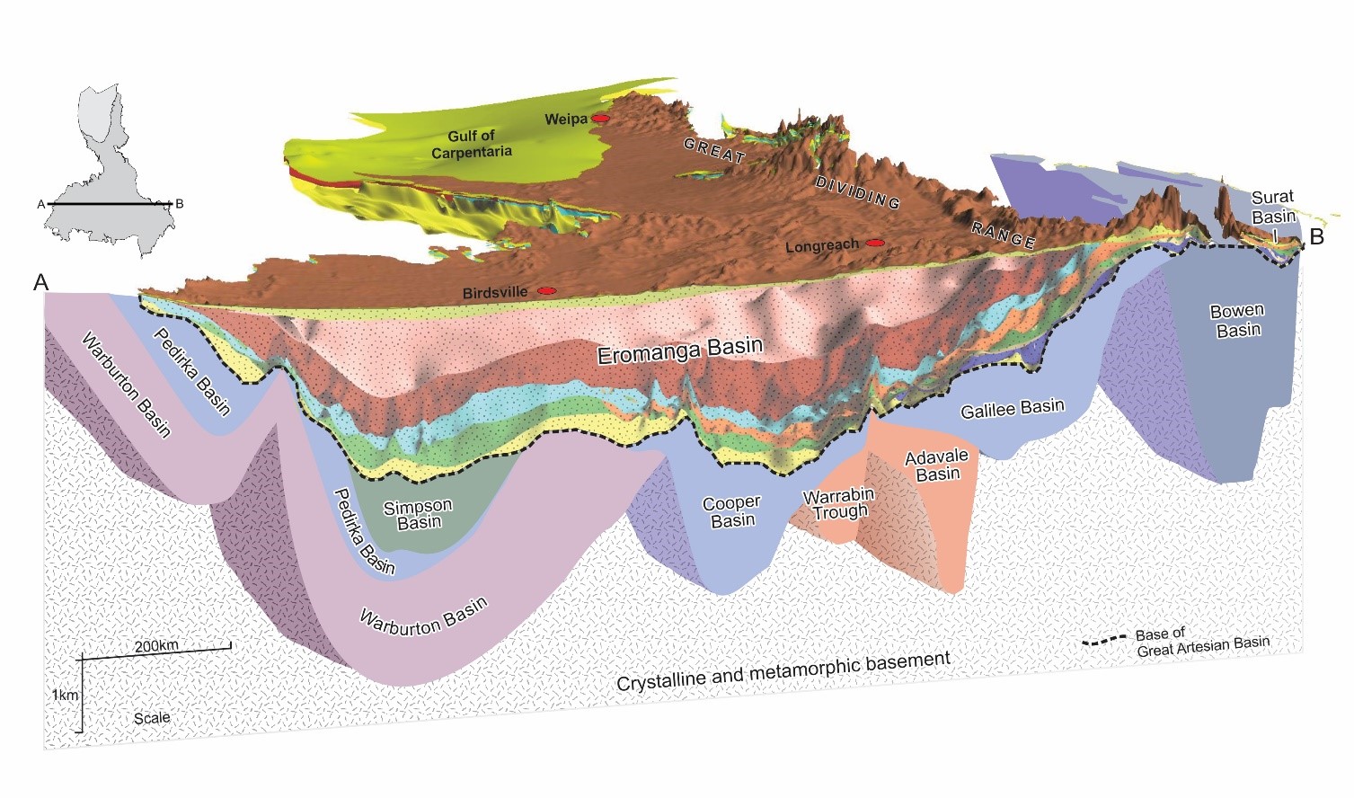
Most recharge water enters the rock formations near the eastern edge of the basin and very gradually flows toward the south and west. Sandstone is permeable and water gradually makes its way through the pores between the sand grains, flowing at a rate of one to five metres per year. Groundwater ages range from almost recent near the recharge areas to more than 1 million years towards the centre of the basin.
Water temperatures ranging from 30–100 °C across the basin, The water from deeper bores are almost at boiling temperature because of the immense heat and pressure at such depths.
Europeans discovered of the groundwater resources in 1878 and more than 1,500 bores had been drilled by 1918. By that time there was evidence of falling pressure across the artesian basin. Groundwater levels have fallen by up to 100m in some areas, with some artesian bores and springs ceasing to flow and reduced discharges from other flowing bores and springs.
But uncontrolled water flow from bores and open earth bore drains has reduced water pressure and volume, threatening the health of ecosystems that depend on groundwater and limiting access to artesian water.
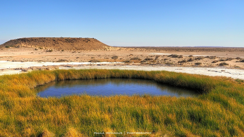
Mound Springs
Natural discharge from the Great Artesian Basin occurs around its margins where confining beds are thin and through fractures from faulting and folding elsewhere in the Basin. Mound springs are an oasis for people and wildlife in outback Australia. There are many plant and animal species that exist nowhere else – mainly due to the constant, but very localised, supply of water. Mound springs take their name from the distinctive mounds that build up around some springs.
Mound springs are of great cultural significance to First Nations people. These springs have been the only reliable permanent watersources in the arid outback since humans first arrived in the region.
The native plants and animals associated with mound springs have been recognised as endangered under both Commonwealth and State government legislation.
Find out more about water resources and catchment management with Australian Environmental Education
The Natural Water Cycle
The natural water cycle shows the constant movement of water around the world. Water moves through the processes of evaporation, transpiration, condensation, precipitation, run-off, infiltration and percolation.
What is a Catchment
A catchment is an area where water is collected by the natural landscape. A catchment is usually surrounded by hills or mountains. Gravity causes rain, melting snow and other water in the catchment to run downhill where it flows into creeks, rivers, lakes and eventually the ocean.
Rivers: the flow of water
A river is a natural watercourse flowing towards an ocean, sea, lake or another river. In some cases a river flows into the ground and becomes dry at the end of its course without reaching another body of water.
What are Wetlands
Wetlands are areas of land saturated or flooded with water permanently or seasonally. There are a variety of wetlands including, inland wetlands, coastal wetlands and human-made wetlands.